The presentations and publications below, available for downloading, provide background material on Forest Watch topics.
Presentations from Recent Meeting
- March 27, 2009 Winter Meeting, UNH
–2007-08 Databook Review(ppt)
Recent and long-term data analysis, Mike Gagnon–Measuring Chlorophyll with Digital Cameras using MVH Images (ppt), Mike Gagnon
–Forest Watch to Maple Watch (ppt), Martha Carlson, UNH, MS Research
–Gilmanton Middle School Student Presentations (ppt), Forest Watch student research and reflections on IGARSS '08 (Intern'l. Geosciences and Remote Sensing Symposium experience), Mary Fougere, Kathryn Clark, Gabrielle Clarke, and Rachel Davis.
–St. Bani School Student Presentations (ppt),
Forest Watch student research and reflections on IGARSS '08 (Intern'l. Geosciences and Remote Sensing Symposium) experience, Robert Schongalla, Like Kalvaitis, Ethan McQueen, Leah Peters, and Sarah Xiao.
Forest Watch Training Materials
- Binder Materials
- PowerPoint Presentation
Data Collection Forms
Forest Watch Protocol Compilation Spreadsheet (PCS)
-
The following Excel spreadsheet programs can be downloaded and used on your computers for entering Forest Watch data. The programs automatically conduct data calculations and place all important data on a master datasheet. Enter your data and save the file with the name of your school and year (i.e. northwestern_98.xls). Either email the saved file to us (forestwatch@unh.edu) or print-out hard copies and mail them to us. Download the instructions below for more information. Note: Excel file also has instructions in it.
–PCS-2000-2.1.xls –Excel spreadsheet for Microsoft Office 2000
–PCS-97-2.1.xls –Excel spreadsheet for Microsoft Office 97
–PCS-95.2.0.xls –Excel spreadsheet for Microsoft Office 95, Excel 5.0, Macintosh
–PCS-2.1-Inst.txt –Instructions for using these files
MultiSpec Materials
The tutorial Exploring a Satellite Image (download below) provides an introduciton to useing the MultiSpec freeware program for processing, manipulating and analyzing satellite iamgery. THe turotial walks the user through various basic functions including downloading the software, opening images, panning, zooming, etc., to more advanced techniques such as band manipulations, i.e. making false color images and exploring the spectral signatures of various land cover features. This tutorial provides a robust introduction to satellite image processing, which can be completed from start to finish in approximately 2 hours.
–MultiSpec Background and Introduction (pdf)
–Exploring a Satellite Image (PC version: Feb 08)(pdf)
–Exploring a Satellite Image (Mac OS X version: Feb 08) (pdf)
In order to use the MultiSpec tutorial, you will need the MultiSpec software. You will also need the subset Landsat image of Beverly, MA, which is used in the tutorial. The image can be obtained directly from the link below. There are a variety of other useful materials about image processing with MultiSpec at the UNH Globe website, including change over time and landcover classification tutorials.
GPS, ALTA, and TopoMap Activities/Forms
–ALTA II Excel Datasheet (with formulas)
–ALTA (old version) Activity & Datasheet
Presentations from Past Meetings
- February 6, 2008 Winter Meeting
2006-07 Databook Review
Recent and long-term data analysis Mike GagnonIGARSS 2008 (International Geoscience & Remote Sensing Symposium),
July 6-11, 2008, Dr. Barry RockGLOBE Carbon Cycle
Investigating the Global Carbon Cycle in Terrestrial Ecosystems,
Sarah Silverberg and Rita FreuderCalciumOxalate and Spruce
Studying the impact of calcium additions to spruce forests in NH's White Mountains, Will KesslerCalciumOxalate and Fir
Studying the impact of calcium additions to fir forests in NH's White Mountains, Tricia McCarthy - December 18, 2006 Winter Meeting
2005-06 Databook Review
Recent and long-term data analysis, Mike Gagnon - December 7, 2005 Winter Meeting
2004-05 Databook Review
Recent and long-term data analysis, Mike GagnonMVH Image
Making Forest Measurements (DBH & Tree Height) with digital photography and MVH Image, Mike GagnonCenote
Using remote sensing to study Cenotes and their associated vegetation in Quintana-Roo, Mexico; Ryan HuntleyCaveDiver
Learnline Presentation on Cave Systems, Cenotes and threats to the fragile ecosystems in Mexico's Riviera Maya; Sam Meachum - December 8, 2004 Winter Meeting
Seasonal Change and Plant Stress Detection
Visualizing vegetation stress with plant stress glasses through seasonal change (phenology) and drying experiments, Dr. Barry RockDBH
Analysis of incremental growth in Forest Watch pine trees, Dr. Stephen HaleCenote
Using remote sensing to study Cenotes and their associated vegetation in Quintana-Roo, Mexico; Ryan HuntleyINHALE
Integrated Human Health and Air Quality Project; studying the effects of poor air quality on human pulmonary function in New England, Tom LambertHemlock Wooly Adelgid
Monitoring the health of your local hemlocks; looking for the presence of the Hemlock Wooly Adelgid, Debra Kimball2003-04 Databook Review
Recent and long-term data analysis, Mike Gagnon
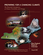 New England Regional Assessment: Overview
A
2001 report of the New England Regional Assessment (NERA) group, one of 16 regional assessments submitted as part of a national look at potential climate change impacts.
New England Regional Assessment: Foundation
Supporting material for the assessments in the overview document.
Photo Release Form