The presentations and publications below are used as training material on Forest Watch topics.
– Remote Detection of Forest Damage
by B.N. Rock, J.E. Vogelman, D.L. Williams, and T. Hoshizaki
Forest Watch Training Materials
- New Protocol (February 2013)
- Binder Materials
- PowerPoint Presentation
Data Collection Forms
Forest Watch Protocol Compilation Spreadsheet (PCS)
-
The following Excel spreadsheet programs can be downloaded and used on your computers for entering Forest Watch data. The programs automatically conduct data calculations and place all important data on a master datasheet. Enter your data and save the file with the name of your school and year (i.e. northwestern_98.xls). Either email the saved file to us (forestwatch@unh.edu) or print-out hard copies and mail them to us. Download the instructions below for more information. Note: Excel file also has instructions in it.
–PCS-2000-2.1.xls –Excel spreadsheet for Microsoft Office 2000
–PCS-97-2.1.xls –Excel spreadsheet for Microsoft Office 97
–PCS-95.2.0.xls –Excel spreadsheet for Microsoft Office 95, Excel 5.0, Macintosh
–PCS-2.1-Inst.txt –Instructions for using these files
MultiSpec Materials The tutorial Exploring a Satellite Image (download below) provides an introduciton to useing the MultiSpec freeware program for processing, manipulating and analyzing satellite iamgery. THe turotial walks the user through various basic functions including downloading the software, opening images, panning, zooming, etc., to more advanced techniques such as band manipulations, i.e. making false color images and exploring the spectral signatures of various land cover features. This tutorial provides a robust introduction to satellite image processing, which can be completed from start to finish in approximately 2 hours.
–MultiSpec Background and Introduction (pdf)
–Exploring a Satellite Image (PC version: Feb 08)(pdf)
–Exploring a Satellite Image (Mac OS X version: Feb 08) (pdf)
In order to use the MultiSpec tutorial, you will need the MultiSpec software. You will also need the subset Landsat image of Beverly, MA, which is used in the tutorial. The image can be obtained directly from the link below. There are a variety of other useful materials about image processing with MultiSpec at the UNH Globe website, including change over time and landcover classification tutorials.
GPS, ALTA, and TopoMap Activities/Forms
–ALTA II Excel Datasheet (with formulas)
–ALTA (old version) Activity & Datasheet
Photo Release Form
–Permission Form for Forest Watch photos (pdf)
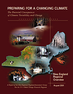
 New England Regional Assessment: Overview
A
2001 report of the New England Regional Assessment (NERA) group, one of 16 regional assessments submitted as part of a national look at potential climate change impacts.
New England Regional Assessment: Foundation
Supporting material for the assessments in the overview document.
